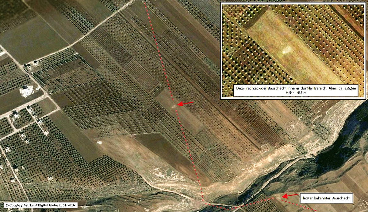
This riverbed-crossing structure can only be verified by indications.
The facts show incoming and outgoing construction shafts with a height of the aqueduct flowing level of approx. 421 m asl. Here, the Wadi el Abdi had to be crossed. From the distances of the nearest localized construction shafts, a route in the area southwest of the current road crossing al Al - Kharja at a promontory Wadi upwards (about 150m) can be determined.
After surveying the existing road and surrounding area in 2007 and 2009 it was clearly proved, that a bridge of about 80m in length had to be built into the wadi bed or into an artificial sill, just after a natural vertical drop of the river bed, due to this altitude. The satellite image from spring in 2009 on the left shows around the red marked Wadi Crossing, a headland heavily moistened through a different type of soil. It is very likely that the backwater creates such an effect through the remains of the still existing crossing in connection with the soil material in the area of that threshold.
A tunnel construction which would have crossed the wadi much further upstream than mines driven tunnel, is unlikely due to the construction shafts. The same applies to a bridge, which should have been built much further undercurrent of the Wadis with a necessary clear span as a flood passage and a resulting overall height.
In summary, it should be noted that at the marked point, additional geophysical methods can prove the exact location and size of the structure.
Within close proximity, the Khirbet el Abdi exist next to the construction shafts, which overlook the entrance to the lower Wadi esh shellale.
In the following, the aqueduct with construction shafts undercuts the high plateau in the direction of Kharja at a greater distance.

Further information about the section between Al Al and Kharja can be found here.