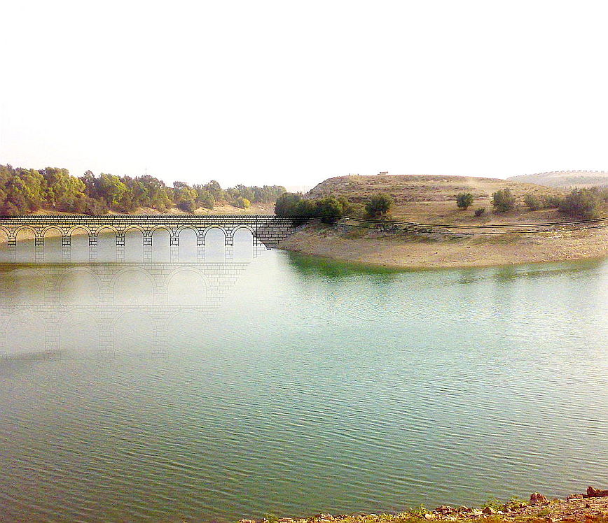
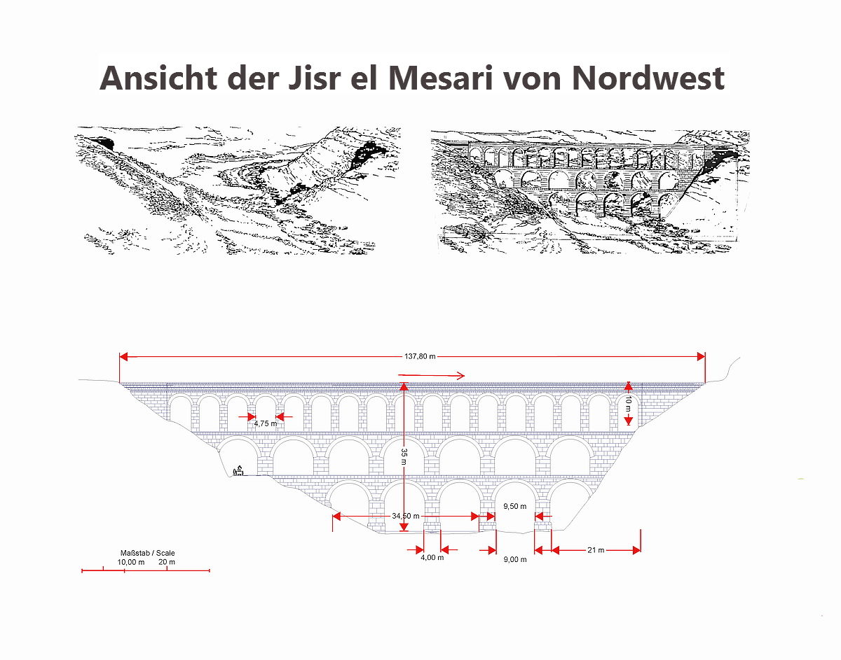
A reconstruction of the bridge over the Zedi east of Deraa from northwest.
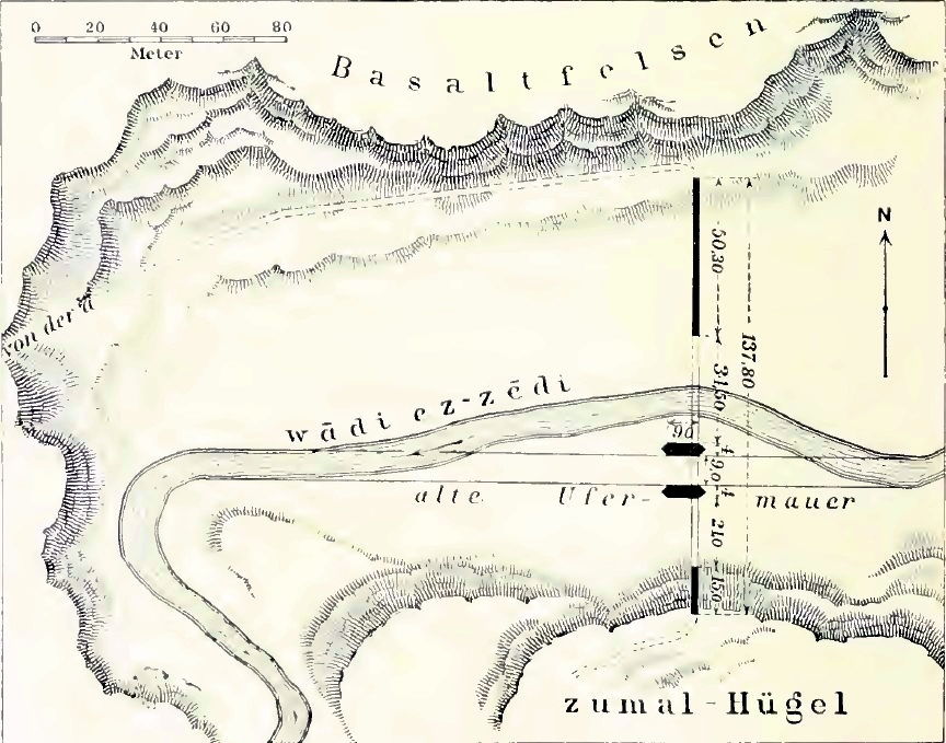
The basis for this were the sketches made by G. Schumacher (1898, Der südliche Basan) and the resulting pier positions of the bridge. In conjunction with this description and the 3D terrain model, I have created the reconstruction in February 2009. (see below)
Here, general "Roman building Rules" were also included in the CAD sketch. The thickness of the arch was usually 1 : 10 of the clear span of the arch. As a rule, the pillars or abutments jumped towards the imposts of the arch inwards and the ratio of the pier thickness to the clear span of the arch was usually 1 : 3. (In later aqueducts or lower arches also pillar ratios of 1 : 4 - 1 : 6 of the clear span of the arch were reached). Above a maximum height of 30m above the ground , a third level of arches was built almost unanimously, only because of static reasons. The river piers, which were extended after undercurrent and lengthened with retaining walls (which forced the Zedi river to run between those piers even in the winter months), described by G. Schumacher, were significant at the Jisr el Mesari.
 Lageplan G.Schumacher
 Visualisierung der Brücke im Foto /Kleb ...thanks for the Pic.: H. Abazid
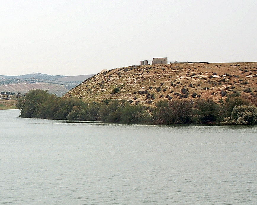
In addition to the Schumacher map, you can see, in the middle of the following photo, the remains of the abutment between the waterfront trees on the west bank. A visualization shows the bridge from northwest in real altitude relation to the water level of the dam.
The procedure for the exact retrieval of the structure:
According to the contour lines of the 3D model and the (but not correct) north direction of G. Schumacher's layout sketch, the area was walked along for several times; but neither remains of abutments nor other indications could be found in 2009 and 2010. This was not surprising, because the real place is located about 350m north of the assumed place. I found the solution by georeferencing old satellite imagery, the map of 1898, and various satellite imagery provided by Google and NASA. The contours of the basalt cliffs and the position of the bridge are identical in all figures. In addition, Google's 2016 footage shows that at low tide, the remains of the river pillar becomes visible. In sum and regarding my pictures with the remnants of the western abutment becoming visible through the waterfront trees, the position of the bridge can be clearly recorded. The visible structures on the aforementioned satellite imagery from 2015 also confirm the overall length of the bridge, as well as the distances given by G. Schumacher.

Arriving at an altitude of 533m asl, the aqueduct sinks in unverifiable cascades over a length of 260m to the beginning of the Jisr el Mesari. Here at the height of the flowing level of 526,5 m asl, the valley crossing has begun in a 50cm wide and, originally at least, 1.50 m high flow channel. Due to the previous steep crash and the change in direction by more than 90 °, there was certainly a pool segment located in front of the bridge, so that sediments could settle and, if necessary, a previous flow cross section could be transferred to the bridge. This bridge cross-section is identical to the bridge in Gadara and adequately sized for the captured water before Deraa. Unfortunately, all of the altitude details in the book "Wasser für die Dekapolis" are completely fictional and both in terms of values as well as the course, the gradient and the position of the bridge are demonstrably wrong.
Following the 526m asl contour line, the aqueduct runs around the peninsula towards the next sub-wadis and then runs from here west to Deraa. Here, it continues.
Already on the Roman road, several kilometers before the Jisr el Mesari, a pressure pipe branched off to Dera'a, find out more here
The most recent satellite images (autumn 2017) show that the residents have taken advantage of the remaining pillar and, by building an eastern abutment, have built a simple bridge to the peninsula. However and as a result, the last remnants of this important building will get lost.