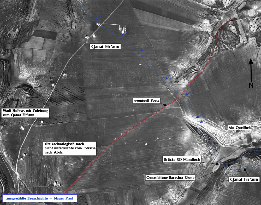
Here you will find information about the bridges in the course of the Qanat Fir'aun.
The bridges were named after the wadis which needed to be crossed or to the respective local situation. The naming of the wadis is uniform according to the maps of the German Palestine Association (DPV) created by G. Schumacher. These maps still have the highest density of information in terms of names and locations. Moreover, over the past 100 years, the place names have either gotten lost, or the old place names, as often verifiable, have been assigned to the next settlement, even if they are several kilometers away from the place of origin.
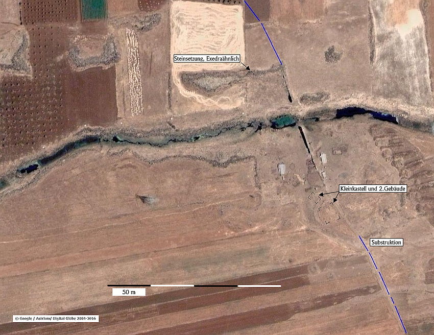
Furthermore, you find the geolocations in the maps. The bridges also include those buildings crossing the Wadis, which were built as siphon pipes right behind a vertical drop below the river level.
About the presumed procedures:
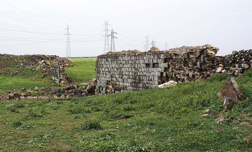
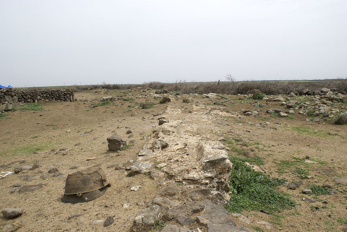
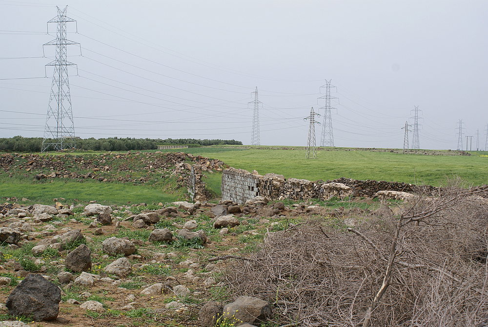
It must be noted that the structures are usually completely dilapidated, grounded, or destroyed – as it happened to the reservoir at Jisr el Mesari. However, the collection of descriptions from ancient literature, the comparison by using height models - according to the performed high-precision surveying and the SRTM data of NASA -, as well as the "on-site situation" led to plausible statements and reconstructions.
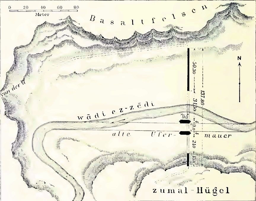
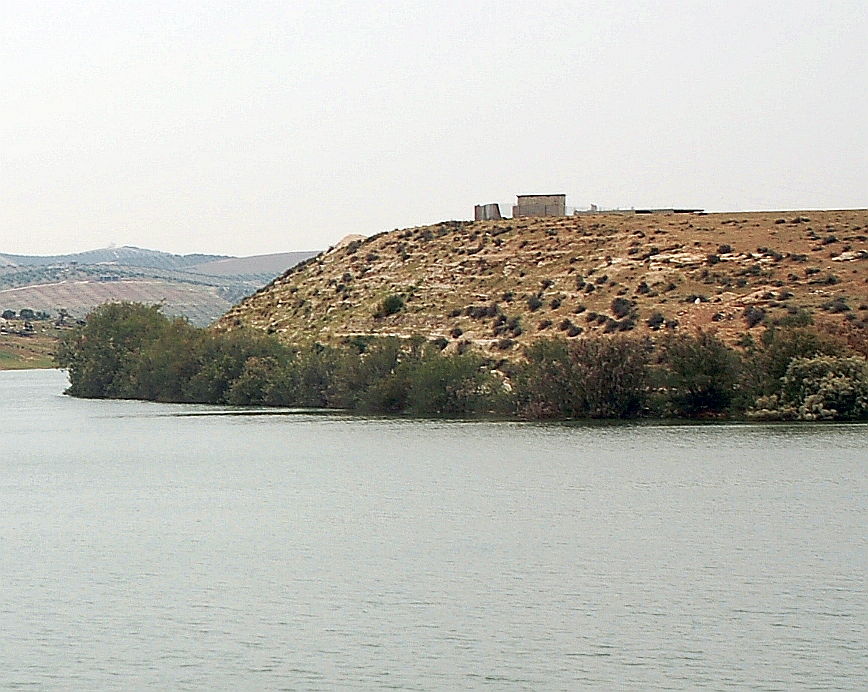
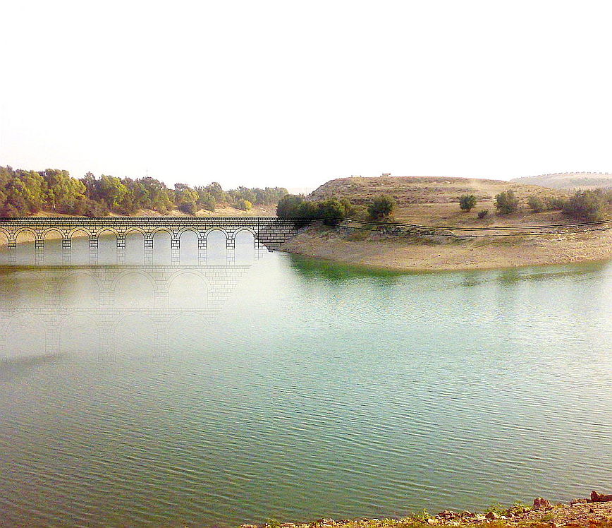
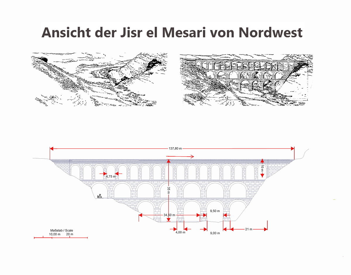
Due to the foundation remains of the abutments and pillars, it is also possible to estimate building details with high reliability. Sometimes, even without any groundbreaking, the statements and theories made here were confirmed. Thus, the previously unknown Wadi Ezra aqueduct bridge, which I found via satellite imagery, could be searched by using GPS and found in the locality. Another of these rare cases deals with the large aqueduct bridge Jisr el Mesari, which was previously located and exactly reconstructed based on elevation data and my analyses. Most recent Google earth satellite images show that it can be found exactly at this point in the currently empty reservoir area east of Dera'a, by regarding the visible remnants of the western abutment and the river pier already described by G. Schumacher.
All these findings are verifiable and, of course, serve as a basis for further solutions.
According to the current state of knowledge, the Roman engineers had to consider the following situation:
- The aqueduct base is deeper than 4m below ground. In this case, it was tunnelled in a mining way, due to the reason that the tunnel was regarded as static stable because of its overburden and geological overall situation.
- The aqueduct base is between 4m below ground and the top of the terrain. Here, a channel was built in open construction or rather beaten into the pending rock and covered in a row, vaulted or rather still showered. Nowadays while regarding the ground or aerial photos, mostly ground depressions are to be found, which developed by the subsequent compaction of the backfilling. Fouling features, which can be found for longer periods in other areas, can only be seen in Syria and Jordan at very specific, limited times of the year.
2.1 A special case could be observed especially here at the Qanat Fir'aun. If the karstified rock did not provide static strength for a tunnel, or if a periodic water-bearing wadi / sink had to be crossed and the aqueduct’s floating level was only up to max. 5m below the top of the terrain, an artificial vertical drop was probably built with a surface similar to a water structure pavement. The aqueduct route was embedded in that vertical drop. In this way, accumulating surface water was drained over the apex of the aqueduct route and the optimal route could be ensured here as well. In addition, a rinsing in the Wadibed and its associated dangers of a tunnel break was avoided. - The route runs above ground on substructures (no real bridge ;-)) with a floating level of max. 2.5m above ground. In this case, vault openings were intentionally omitted, since the construction and formwork requirements would have been much higher and the simpler and faster construction of a closed substructure was preferred.
- At flow level heights between 2.5-3m above ground a brook / wadi is usually crossed. In addition, clear widths from 3m and clear heights usually greater than 2m resulted from common Roman arch forms.
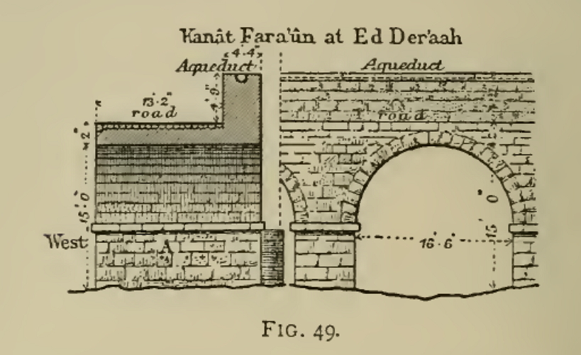
- In the case of a route higher than 12m above ground, not only several openings are obligatory, but also two rows of sheets have been made one above the other. With the Zeidi-bridge Jisr el Mesari it can be undoubtedly assumed that it is a bridge consisting of three rows of arches; because and according to Gottlieb Schumacher’s specifications it can be assumed as well that the complete height of the bridge was 37m.
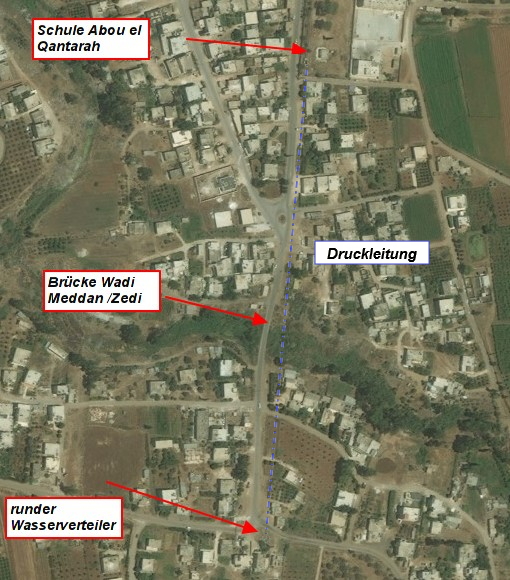
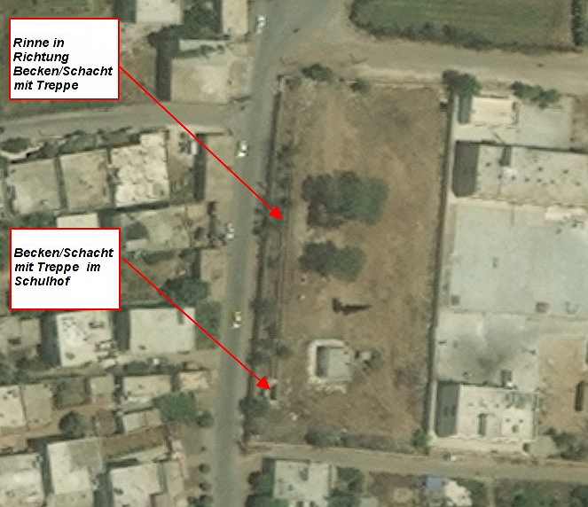
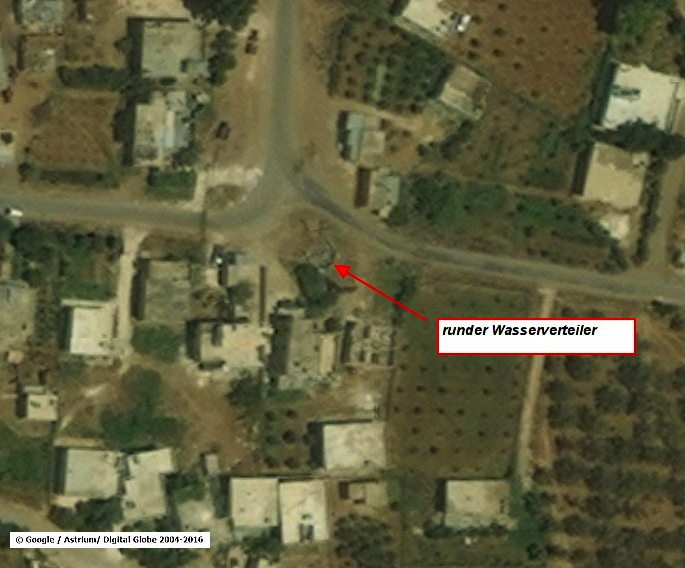
- Pressure lines should also be considered as exceptional cases. Here, the premise was to reach the goal. In terms of height, it was possible to reach buildings which, in addition to a depression, were also separated from the supply line by existing structures or incalculable floodplains. Both occur in the Qanat Fir'aun. On the one hand, the accessibility of the so-called "Hammam Siknany", a Roman nymphaeum of the Kalybe type, is only possible via a pressure pipe, as this is the only way to reach the required height. On the other hand, the incoming aqueduct, at today's Abu el Qantara, was designed as a floor-level channel. According to the bottom of the aqueduct, a more than 600m long substructure with a max. height of 4m would have had built. Here, however, are various cataracts of Wadi Meddan ez Zeidi which upper stream could have led to floods and flash floods.
As a result, a pressure pipeline, which nowadays can be still verified via the inlet and outlet basin, was constructed. This allowed the all-winter masses of water to drain off the pressure line which laid between the basalt rocks. In this way, a possible accumulation of piers or substructures was avoided. Further information about these structures can be found on the individual subsites.
Considering the Qanat Fir’aun, it should be differentiated between those bridges:
- Valley bridges (up to 3-storey bridges with heights from 10m above the valley floor)
- Wadi-crossings (usually over 150m long bridges, which only have the necessary flood openings in order to cross the river)
- bridges led in vertical drops of the riverbed, (from the proven height level as "normal" tunnel crossing of a wadi; to be excluded and due to the incoming and continuing shafts / substructures positionally clearly locatable buildings) which run just below the present level of the wadis.
- Pressure line / siphon bridges (indicated by indications and heights, characterized by missing building remains, but by existing pools / and / or literature descriptions verified aqueduct route)
For further and additional information you can also use the main menu, or the full-text search, via the main menu "endeavor" ☺️
The order of the bridges corresponds to the position in the course of the aqueduct route. In the content area (right) of each subpage, you also find a link to the directly following Qanat Fir'aun section, regardless of whether it is a bridge, substructure or tunnel.
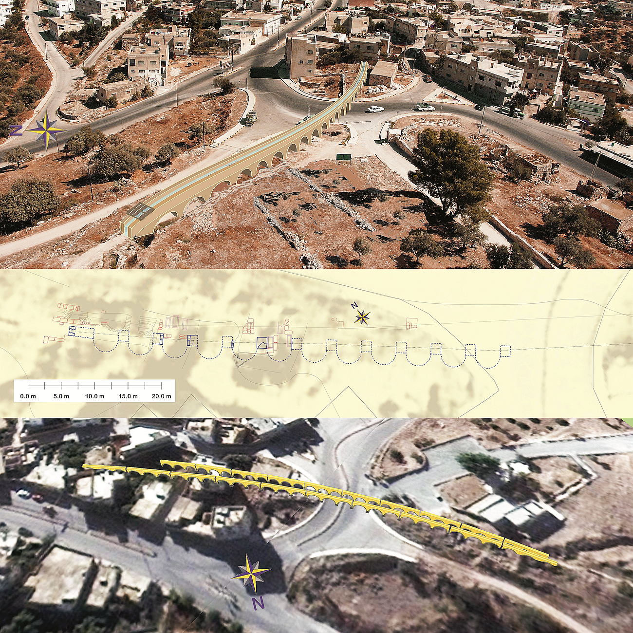
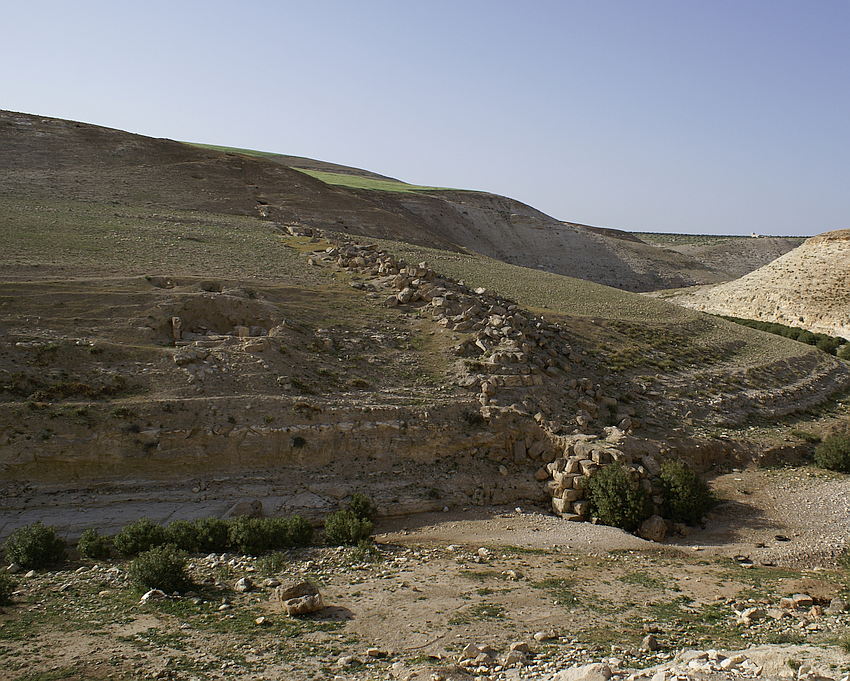
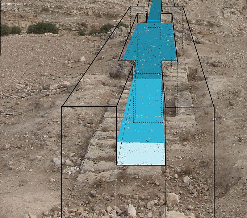
Next to it, you see a visualization of the Wadi esh Shellale Bridge, based on satellite images (Google), SRTM elevation data (NASA JPL) and survey data from 2003 (Kleb / BAI Wuppertal)


")