, led a water channel on grade and along the contour lines, towards Abou el Qantara.
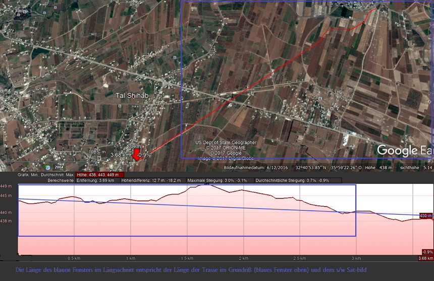
This part of the aqueduct ran between 443m asl and 437m asl.
The adjacent picture of the AWM from 1917 shows Australian troops refreshing themselves in a similar Roman aqueduct that was still functional in northern Palestine.
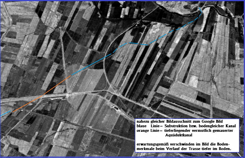
In addition to a still existing brick channel running from the lake of Muzeirib, there is also another plausible routing, which, however, was recognizable only from old satellite images and could be checked by means of elevation data.
 ausgewertetes Google Sat-bild mit Höhenplan
 gleicher Ausschnitt mit möglichem Trassenverlauf wie blaues Fenster des Google Sat-Bildes
However, it also shows clearly the basic methods for finding such a route.
- On the one hand, the strongly tortuous lines of the road between Muzeirib and Abou el Qantara show that the accompanying and masonry canal had existed before the road was built along this route much later. Due to the terrain heights, a newer water channel would have had to be run on the same route; but an already existing road at that time would certainly have run straight between the places, since there were no constraint points in this area.
Incidentally, the same phenomenon can be found on other aqueduct routes. As an example, the Minturnae (Italy) aqueduct is mentioned, which in some sections also gave later constructed roads their course and direction. - On the other hand, the soil depressions and fouling characteristics, especially on old satellite images, are an important indicator of old building structures. If those can be referenced with today's precise elevation models, both the location, in today’s mostly completely changed terrain, can be included in an archaeological survey, as well as the congruence between incised and above-ground running channel and between longitudinal elevation and the maps are checked.
The Qanat Fir'aun leads to the siphon bridge / pressure line over the Wadi Meddan, at today's Abou el Qantara. Information on this can be found under the following link Wadi Meddan Crossing.