, or Khirbet er Rahub on the Muallaqat he Rahub
Already S.Mittmann wrote in his book about Northern Jordan, that for a temporal allocation of the plateau the usual methods do not apply. He could not find ceramics or any other artifacts that could be classified.
So we have to go back to the search for facts in the literature.
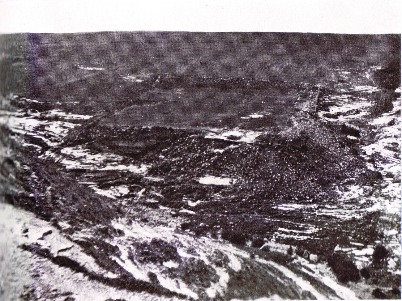
 Foto der Khirbet er Rahub von Ostnordost / C.Steuernagel
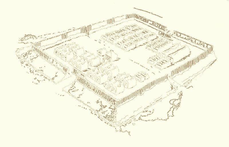
 Skizze eines typischen römischen Marschlagers, oder eines temporären Zeltlagers
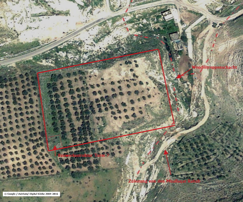
There was / are directly at the Khirbet he Rahub two springs, at the southeast corner of the plateau the Ain Rahub, at the center of the north side, the source was rebuilt in 2010. Ain Um Furun, was named at G.Schumacher (map of the DPV B4) with Ain it Sukkar. Both were inflowing sources into the Qanat Fir'aun. After the Aqueduct was coming out of the Wadi esh Shellale, not circling the massif of Al Mughair, the aqueduct continues to went through massiv eroded cliffs with steepy steps above and below the road and approaches to round the ruins of the Khirbet er Rahub. Hardly cutting this plateau on the eastern and northern flanks, the aqueduct then turns north again towards Al Al and Kharja (also called "Dschorda" in E. Brandenburg in 1914).
In addition, three more upstream sources were fed from the south, at the Khirbet er Rahub, in the aqueduct. S. Mittmann does not mention the spiral stairwell found by the Qanat Fir'aun team in 2007, but sees a spring directly on the northeast corner without any further description, the southern one is bricked up !! All water was directed to the pumping station in the 70s.
Through various construction activities and Bulldozereinsatz the long north side and the east flank have been massively damaged since my first visit in Sept 2003. Probably as a result, the "spiral stairwell" has come to light again.
G. Schumacher describes the plateau almost rectangular with 168x70 m. (S. Mittmann has slightly different dimensions)
On the northern edge is still visible a walled 6m wide road. In the middle of the northern flank and next to the source (Umm Furun / Ez Sukkar) was one of the gates of the fort.

Due to its striking location, but any absence of massive building remains, I believe that this constructed platform originally was a Roman temporary auxiliary fortification to build or protect the aqueduct route . Next to the road and the gate and within the "castellum" there were probably tents and places for cattle and horses and perhaps a fortified building. This building was presumably on the southwestern corner of the platform, or as was often found elsewhere, smaller towers.
G. Schumacher himself speaks of "a fort for protection of these sources", but without making any further assignment.
The entire information was apparently not available for S. Mittmann, since he does not refer to it and does not compare the state at that time with his survey results. Likewise, as mentioned above, due to the lack of ceramics, he does not prescribe the temporal classification of the stone plateau. He in turn looks at the pathway-relations, as well as the name-giving caves located here in the hillside and writes at least referring to the Crusader time about it as "rightly referred to as Cavea Roob".
The "Cavea Roob" are also located on many archaeological-topographic maps, for example, the Historical-Archeological Map Palestine Leaf North.
Bronze or Iron Age settlements are in immediate proximity and can be demonstrated by their typical shape and ceramic findings and can be clearly excluded for the Khirbet er Rahub (see also S. Mittmann).
The proximity to the aqueduct, to the water in general and the sheltered location in the immediate vicinity of the main Roman trade route of this area - all this speaks not only for a construction in Roman / Byz. Time. Possibly even extensions were made during the Crusader era, so the timing of the found spiral stairwell shaft can only be plausibly assigned to this time. This construction was rather uncommon in the other (Roman) context and the size and type of the execution speaks also for a subsequent enlargement.
On the b / w picture from C. Steuernagel's "Adschlun" taken from the east, the shaft could not be recognized because it was buried under the masses of collapsed walls of a supposed corner tower.
Surrounded by a wall up to 10 m above the incoming old road-connections and extended by a permanent water supply within the system, the Kh. Er Rahub certainly corresponded very well to the requirements of the Crusader period.
The additional location of Bet Rehob, sometimes mentioned in the literature, also known from the Judgment Book of the Bible, is only vague, and refers more to Tell el Muallaqa some 100m further south, or Tell er Rahub. According to S. Mittmann the Tell er Rahub is called "Tell el mgeyir" and lies on the ridge east above the Ain er Rahub. According to the Bible, Rehob was a rather rich city that resisted and lay in a fertile plain near the Dan. Often (though not always), the River Dan is identified with the Jarmuk or Wadi Medan, especially in ancient literature. So there are some scholars who seek this rebel on Tell esh Shehab.
The Qanat Fir'aun now continues along the western slope of the Wadi er rahub and follows the Wadi esh-shellale before flowing across the plateau towards Al-Al and Kharja. (Here you find the link to the following aqueduct section)