which is the only wadi of the Qanat Fir'aun still existing in parts.
Within the search for the aqueduct route of the Qanat Fir'aun, I was able to develop, in the years from 2007-2009, a closed three-dimensional terrain model. Starting from the dam discovered in Dilli in 2007, its altitude and other remnants of the aqueduct taken from maps, resulting compulsory points lead in further research to presumable lines of the overall route.
By superimposing satellite images of different ages, further structures could be associated to hitherto unknown aqueduct sections; already described ones could be detected again.
In the further analysis, a structure could be identified on the satellite images, which only could be interpreted with high probability as an aqueduct bridge.

In 2009, it was possible to visit this place east of today's city Sheik Mishkin. No roads were leading to that lost place, but we were able to reach the place by using Gps , walked along Paths and across Fields. So the theoretical work could be confirmed, by finding this Bridge.

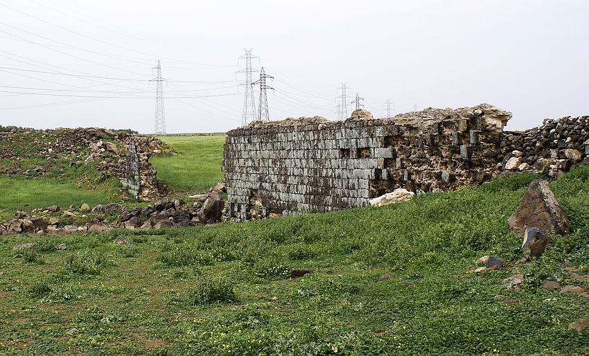
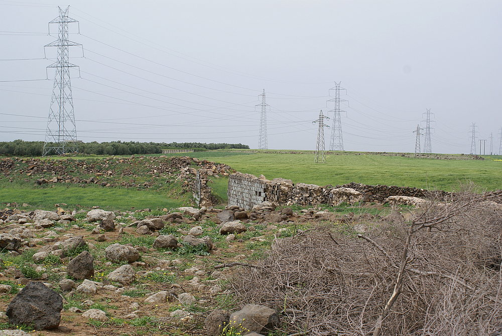
The previously completely unknown bridge is about 135m long ,1.80m wide and build upon a Socket of a width of 2,10m. The Construction is made from a basalt shell construction, the Opus Implectum. In this case, it meant regular stone rows of basalt cuboids were built as outer formwork and then filled with Opus Cementitium and large Pebbles, after that both parts where compressed for higher solidity. The remaining structure, with a maximum height of about 8m between the Specus and the wadi bed, has in parts still a 1 ptolemaic cubit wide flow channel (~53.2cm, this corresponds also nearly the much older large Syrian cubit) and was made of hydraulic Concret. (Opus Signinum). So the total hight over the River bed was around 9,50m. During the centuries, floodings and earthquakes has partly destroyed the bridge in the middle,this collapse is about 27 meters wide. Downstreams no stones of the fallen vaults were found, so that on the basis of the height of the bridge, the necessary vault thickness and coverage to the lower edge of the specus could be reconstructed (the actually water - bearing corpus of the aqueduct). It must have been 3 vaults (semicircular arches) with a wide of about 6 to 7m and a thickness of about 50-60 cm. Neither Bridge imposts nor vossoir stones could be found in the brief time. The condition of the front walls in the further course is conceivably bad, due to the reason that the accurately cutted and partially embossed basalt cuboids of the outer shell are still broken out and reused by local shepherds and beduins for enclosures and huts.
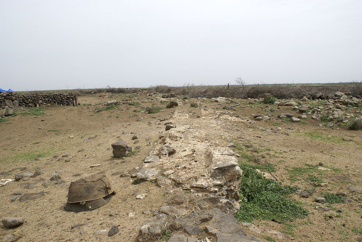
In southern direction, the course of the aqueduct could still be documented on the ground surface over a length of 200m, after that the structure could not be found anymore in the ploughed acre.

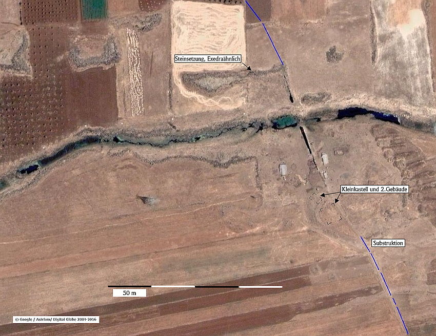
On the northern side, the incoming route cann't be followed after a bend to northwestern direction at the end of the bridge. However, on the northwestern side downstream at about 40 m distance, a weathered stone setting was found, which can be interpreted as an exedra of a small water sanctuary due to its semicircular shape and accented edges. The assumption that with high probability and in close proximity to the bridge a ford existed, can be confirmed by a, still in the bottom contour recognizable, 20x20m large, almost square structure downstream of the bridge at the southwestern end.

This structure which was aligned direct next to the bridge, formed a small rectangular plateau. Scattered Terra Sigilata (widely used in the Roman military stoneware, usually with a shiny red surface) may indicate a small fort, which served as a protection for the aqueduct as well as for the ford.
A few kilometers north-northwest of the bridge, a comparable situation of a fort directly at the aqueduct line, could be also verified by using satellite images.
The significance of this newly discovered aqueduct bridge is that, that it is the only surviving remains of this Aqueduct of this complexity and height. Many other shorter areas of the aqueduct, which were built on grade, or only 1 or 2 meters above the terrain along the contour lines, are no longer in situ, had been rebuilt, removed or plowed away. In the context of the probable small nymphaeum and the remains of the fort, the local situation is certainly a worthwhile object for future research, in case the political conditions allow it and the destruction will not proceed.
The Qanat Fir'aun leads further south. You will get more information about the following section here.